At AllTheScience, we're committed to delivering accurate, trustworthy information. Our expert-authored content is rigorously fact-checked and sourced from credible authorities. Discover how we uphold the highest standards in providing you with reliable knowledge.
What is Aerial Photogrammetry?
Aerial photogrammetry is a technique for creating two dimensional (2D) or three dimensional (3D) models from aerial photographs, which are pictures of the Earth from a high point, usually an airplane. These photographs are then turned into the models by cartographers. Aerial photogrammetry usually requires photographs of two or more angles of the same area in order to map the image, and it may or may not involve computer software.
For the most part, aerial photogrammetry is used to create topographical maps. These maps may be either 2D or, more recently, 3D computer models of terrain. The resulting maps and models may be useful in analyzing both small and large geographical areas. These maps may be used as a basis for, or in conjunction with, Geographic Information System (GIS) data.

Aerial photogrammetry may also be useful in a variety of industries. It is commonly used in architecture and land development. In addition, these mapping techniques may be used in environmental studies of a terrain, such as watershed or deforestation research, in city planning, or even in film production.
Most of the images used in aerial photogrammetry are obtained through cameras mounted to the undersides of airplanes. If the image needs to be taken from a low flight path, the camera is typically mounted to a small, remote-controlled airplane. Flight restrictions in many areas prohibit manned airplanes from flying too low over residential and business areas.

The flight pattern of the plane will typically meander back and forth over an area as the camera records the images. This pattern is meant to allow each area to be photographed from multiple angles. The aerial photogrammetry process almost always requires photographic data from multiple angles.
Photogrammetrists need multiple angles in order to determine the relative positions of objects in the photographs. This process is accomplished by isolating the same points in each photograph and triangulating their positions relative to each other. This process is typically accomplished with the help of a stereo-plotter, specialized computer software, or both. Stereo-plotters allow a cartographer to see two photographs simultaneously to better compare the points of interest.

In many cases the photographic data may not be enough to determine the full picture of the landscape. This may be especially true when creating a 3D landscape model. Therefore, aerial photogrammetry often combines other types of data with the photographs by using instruments such as Light Detection and Ranging (LiDAR), laser scanners, or white-light digitizers.
AS FEATURED ON:
AS FEATURED ON:

-
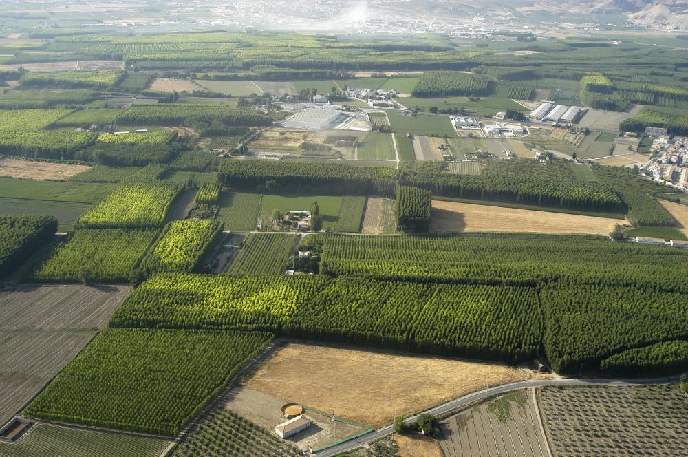
![Maps made from aerial photogrammetry are often used in conjunction with GIS data to add more detail and information to the maps.]() By: Nataly-NeteMaps made from aerial photogrammetry are often used in conjunction with GIS data to add more detail and information to the maps.
By: Nataly-NeteMaps made from aerial photogrammetry are often used in conjunction with GIS data to add more detail and information to the maps. -
![Aerial photogrammetry may also be useful in a variety of industries, such as architecture and land development.]() By: Paco AyalaAerial photogrammetry may also be useful in a variety of industries, such as architecture and land development.
By: Paco AyalaAerial photogrammetry may also be useful in a variety of industries, such as architecture and land development. -
![Aerial digital photogrammetry, often used in topographical mapping, begins with digital photographs or video taken from the bottom of an airplane.]() By: iofotoAerial digital photogrammetry, often used in topographical mapping, begins with digital photographs or video taken from the bottom of an airplane.
By: iofotoAerial digital photogrammetry, often used in topographical mapping, begins with digital photographs or video taken from the bottom of an airplane.


Discussion Comments
@MrMoody - I used to work as a Geographic Informations Systems analyst and a lot of the data I imported into my software came from aerial mapping applications.
It imported digital raster images and of course gave the latitude and longitude of different locations. I used the maps as backdrops for spatial analysis and even reports that showed how populations of people were clustered in different locations.
It was a very interesting job and the executives were impressed with the maps that the software produced.
@nony - Looking at maps is neat, but I think that one of the coolest uses for photogrammetry software is in law enforcement.
My brother works as a police officer and he says that they take photographs from crime scenes and run them through this software program that builds three dimensional models of the scene, and also simulates the dynamics of what has happened – like in a traffic accident for example.
They can recreate the vehicles and simulate their motion through 3D space, all the way to the point of impact. This gives them a better idea of what happened instead of relying solely on witness testimony of how the accident took place, which of course can be tainted.
@miriam98 - Personally, I don’t think satellite imagery is used to create the images that you were looking at but I could be wrong.
I believe that at that level of detail, you’re basically looking at aerial photography. I imagine it must be a very tedious process to map out the entire United States in this manner, and to do it from different angles.
What’s really impressive is how they use analytical photogrammetry to construct three dimensional models based on the photographs they take and the calculated angles.
The closest I’ve come to seeing this on my personal computer is a 3D terrain program that is sometimes used for games. It creates realistic three dimensional terrains complete with textures and lighting. I think they probably use the same kind of algorithms when they make the 3D topographical maps.
I remember the first time I used online mapping software a few years back and saw an aerial view of my house. I was absolutely stunned at the level of detail and the clarity of the images.
It even showed the car parked in the driveway. Immediately I began typing in other addresses of other places I had lived in and was taken there immediately by the software. I wondered if they used planes or satellite imagery or both to get these images.
I imagine that it would take a lot of time and computer processing power to create these images but I think that it’s worth it.
I usually go online to get directions for places I’m going to, and the topographic aerial maps sometimes come in real handy to make sure that I’ve got the right location.
Post your comments