At WiseGEEK, we're committed to delivering accurate, trustworthy information. Our expert-authored content is rigorously fact-checked and sourced from credible authorities. Discover how we uphold the highest standards in providing you with reliable knowledge.
What Are the Connections between Remote Sensing and Image Processing?
The use of remote sensing and image processing is a means of obtaining information from a distance about an object and making an image of it. Aerial sensors and cameras on airplanes, satellites and spacecraft collect data by measuring how light radiation signals — called electromagnetic radiation — interact with the Earth's surface. This data is used by an image processor to create scientific graphs, geographic maps and aerial survey photographs.
When electromagnetic radiation or light radiation hits the surface of an object, it can be reflected or absorbed. Electromagnetic radiation can reflect at an angle in a specular reflection or scattered into many rays in a diffuse reflection. Absorbed electromagnetic radiation turns into heat energy that raises the object's surface temperature. Remote sensing equipment detects how the electromagnetic radiation is reflected or absorbed and translates it into data that an image processor turns into a digital image.

Electromagnetic radiation can be detected by light-sensitive film in a camera or by electronic sensors. Light-sensitive film is treated with a photo-reactive solution that chemically reacts when light hits it to create a picture. Electronic sensors record electromagnetic radiation levels and transmit them as data. The data is placed into a two-dimensional, rectangle-shaped grid of numbers called a raster that is composed of square units called pixels or cells. Each number in a pixel represents a different brightness level of light.
Image processors use this data, called raw data, to correct any distortion that might be present in an image. Distortion can be from the image-processing equipment or a phenomenon in the environment. Radiometric correction fixes an uneven sensor response in an image. Geometric correction uses information to correct distortion in an image caused by the rotation of the Earth.
After the imaging processor corrects any distortion that is present it determines the signal's spectral character. Its spectral character includes visible light, infrared light, thermal infrared and radar. Multi-spectral remote sensing is the process of detecting radiation signals, determining the signal's spectral character, filtering it into different light wavelengths and creating an image to represent the wavelengths.
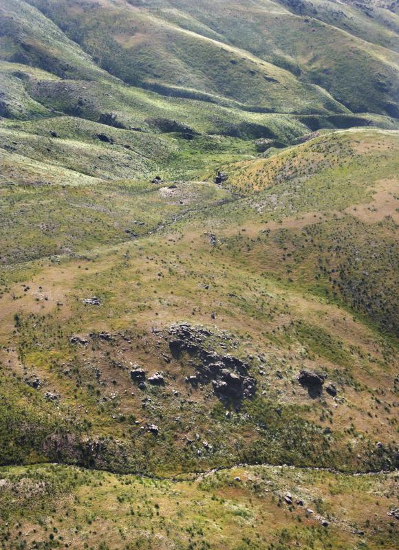
Objects have unique spectral signatures or spectral reflectance. Spectral signatures are used by scientists to detect dry soil, vegetation and bodies of water. Images created by remote sensing and image processing are used to forecast the weather and to make topography maps. The fields of mining and geology use remote sensing and image processing to look for ores and oil.
AS FEATURED ON:
AS FEATURED ON:

-
![Remote sensing and image processing used to map topography of an area.]() By: iofotoRemote sensing and image processing used to map topography of an area.
By: iofotoRemote sensing and image processing used to map topography of an area.
Discuss this Article
Post your comments