At WiseGEEK, we're committed to delivering accurate, trustworthy information. Our expert-authored content is rigorously fact-checked and sourced from credible authorities. Discover how we uphold the highest standards in providing you with reliable knowledge.
What are Cirrostratus Clouds?
Cirrostratus clouds are high-placed clouds located roughly 16,404 to 42,650 feet (5,000 to 13,000 meters) above Earth's surface. They take their name from the words cirrus, meaning "curled," and stratus, which means "spread out." The appearance of cirrostratus clouds differs between types, but is generally thin and composed of small fibrous wisps. When clustered together, it is extremely difficult to distinguish one cloud from another. Cirrostratus clouds are generally indicative of high-moisture concentrations in the upper atmosphere, making their presence a sign of possible weather changes.
There are several types of cirrostratus clouds. Cirrostratus fibratus are clouds that appear like fibrous sheets in the sky. Cirrostratus nebulosus, on the other hand, are much less defined and often resemble fog when in groups. Cirrostratus undulatus clouds have wave-like patterns, while cirrostratus duplicatus are cirrostratus clouds layered on top of each other. The different types are formed based on the moisture and ambient temperature present at the time and location of the clouds' formation.

The clouds are composed mainly of very small ice crystals, which form from evaporated water in the upper atmosphere. Warm air meets cold air in the troposphere in even, well-spaced layers. As the moisture in the warm air cools, it begins to freeze into ice. The ice, when in small sizes and separated over wide spaces, forms cirrostratus clouds. This process also occurs when other kinds of cirrus clouds shift from one form to another.
The composition and wide spacing of cirrostratus clouds makes them very thin by nature, as well as translucent. The sun and the moon can be more easily seen through cirrostratus clouds as compared to other types of clouds. Light often bends around and through a cirrostratus cloud, forming a halo in the sky. Since these clouds are so thin, they are usually indiscernible from one another when clustered together.
The composition of cirrostratus clouds has several weather implications. Their appearance suggests the early accumulation of moisture in the atmosphere, particularly in the upper portion. Although this is not necessarily predictive of precipitation, it is indicative of an approaching warm front. Should the clouds enter the warm front, the ice crystals forming the cloud can melt and lead to precipitation within one to two days. In the case of cirrostratus nebulosus, in which ice crystals are at higher temperatures than other types of cirrostratus clouds, precipitation usually occurs within eight to 24 hours.
AS FEATURED ON:
AS FEATURED ON:

-
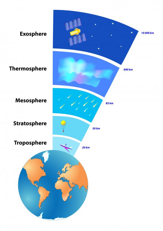
![The troposphere is the layer of the Earth's atmosphere that comes into contact with the ground.]() By: designuaThe troposphere is the layer of the Earth's atmosphere that comes into contact with the ground.
By: designuaThe troposphere is the layer of the Earth's atmosphere that comes into contact with the ground.
Discuss this Article
Post your comments